The Okavango Delta
The jewel in the crown of Africa safari
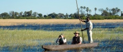
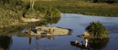
Arguably one of the most famous floodplains in the world, the Okavango Delta is seen as a mecca for those that are wanting to experience the best that safari can offer. Geologically formed by the depression between two lateral plate rifts, this ecosystem was formed millions of years ago and once allowed the floodwaters from the Angolan Highlands to flow to what was Africa’s largest internal lake, Lake Makgadikgadi (the pre-cursor to the now-present salt pans).
Today, the flow of water hasn’t really changed all that much but to understand the floodwaters of Angola and how they impact on this area of the world, creating not just the Okavango but also the Savute, the Linyani and contributing to the Chobe rivers, is to really get to the heart of the main safari areas of Botswana as a country.
The Angolan Highlands
Loosely speaking, a large part of the reason for the abundance of wildlife that immigrates to the fringes of the delta yearly (and moves freely through to the other areas of north-western Botswana), is that, as Southern Africa starts to dry, from April onwards, the floodwaters from the Highlands of Angola begin their journey along the Kavango River through the northern part of what is known as the ‘panhandle’ of the delta. This water then drops down into the depression at the north of the delta and then gently fills the floodplain from late April until the end of October until the waters have run out along the Boro, the Gomoti, the Boteti and the many other rivers that flow out from the southern delta areas.
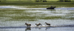
This water provides a lifeline for the animals of Southern Africa, giving life and sustenance during what is (especially for the desert dwelling animals of the Kalahari to the south) another dry and harsh dry period in the yearly cycle. (which actually occurs during southern Africa’s winter rather than summer period) For more information about the flow of the delta and the approximate timings of the waters please see our section on the Okavango Floodwaters below.
The Moremi Game Reserve
One of the other main reasons that Botswana and the Okavango is such an important destination for safari is down to the decision of the BaTawana peoples in the 1960s to create a protected area of land known as the Moremi Reserve. Originally comprising the mopane tongue area of land to the East, this was enlarged in the 1990s to include the fabled ‘Chief’s Island’ to the west. This pioneering move is seen as the first wildlife reserve in Africa that was created by native Africans and has established Botswana and the region around the delta as one of the most productive areas in Africa for wildlife viewing.
The Moremi Game Reserve is right at the heart of the Delta and is still an area that is open for anyone to visit (following the strict guidelines for camping and driving) and encompasses much of what the Delta is fame for such as the floodplains, mopane forests and the myriad of river systems that form as the floods come through. In Chief’s Island, you have, arguably, the best game viewing numbers and experience in Africa…with also the highest ticket price in Africa for its two properties, Mombo/Little Mombo Camp and Chief’s Camp.
Private Concessions
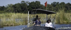
In combination with the Moremi National Park, there are a series of concessions (the main ones ranging from NG11 to NG34) that surround the Okavango and offer a visitor a much more privileged experience of the Delta and safari in general.
Following on from the policies instigated in the 1980s regarding the park fees and general conservation guidelines, the government also started offering the ‘NG concessions’ to private companies who could pitch for a short-term lease on the land (normally around 15 years) with the lease given to the company that could demonstrate that their business model would actively support the local communities as well as protecting the land and animals there.
This move has proven so successful that the Botswana or today is the envy of the rest of safari Africa with the highest yields and the lowest impact from tourism of any country in the continent.
For a run through of the main concessions around the delta please see our section on The Okavango Concessions.
The Panhandle
The last area of the Okavango Delta worth consideration is up at the very top of the delta, north of the plate depression, and where the early floodwaters from Angola arrive into the delta and signal the start of another year of floods.
Often ignored as far as game viewing is concerned and often associated with fishing camps, this is still a very productive region of the Okavango (mainly for birding) and is certainly somewhere that is more achievable for those on a budget or looking for a safari experience that is reminiscent of Botswana’s safari industry 20 years ago! The properties up here are often still owner managed, and, with some very good birding and fishing, it is certainly not for those looking for plenty of big game, but it is still a great spot to consider.
The Okavango Floodwaters
‘Wet’ and ‘dry’ camps are often mentioned when talking about the Okavango Delta and this is in reference to the amount of flood water that is in and around the camp. For many, a detailed understanding of the floodwaters that gentle infiltrate the Delta between April and November is unnecessary as the region is so stunning that it can be visited throughout the year but, a basic understanding of the effects on camps is, we would argue, a good starting point when planning a trip.
Roughly speaking, the floodwaters that are formed from the rainfall in Angola in the South African summer months between December and wend their way down through the panhandle and into the delta arriving some time in the middle of April. The waters then fill out the Delta to reach their peak depth between May and August to then dissipate until the local rains of February start to re-fill in preparation for the main ‘push’.

